Autonavi Maps unveils "Wonderland" engine, applying cutting-edge technologies such as neural rendering to create "space-time maps"
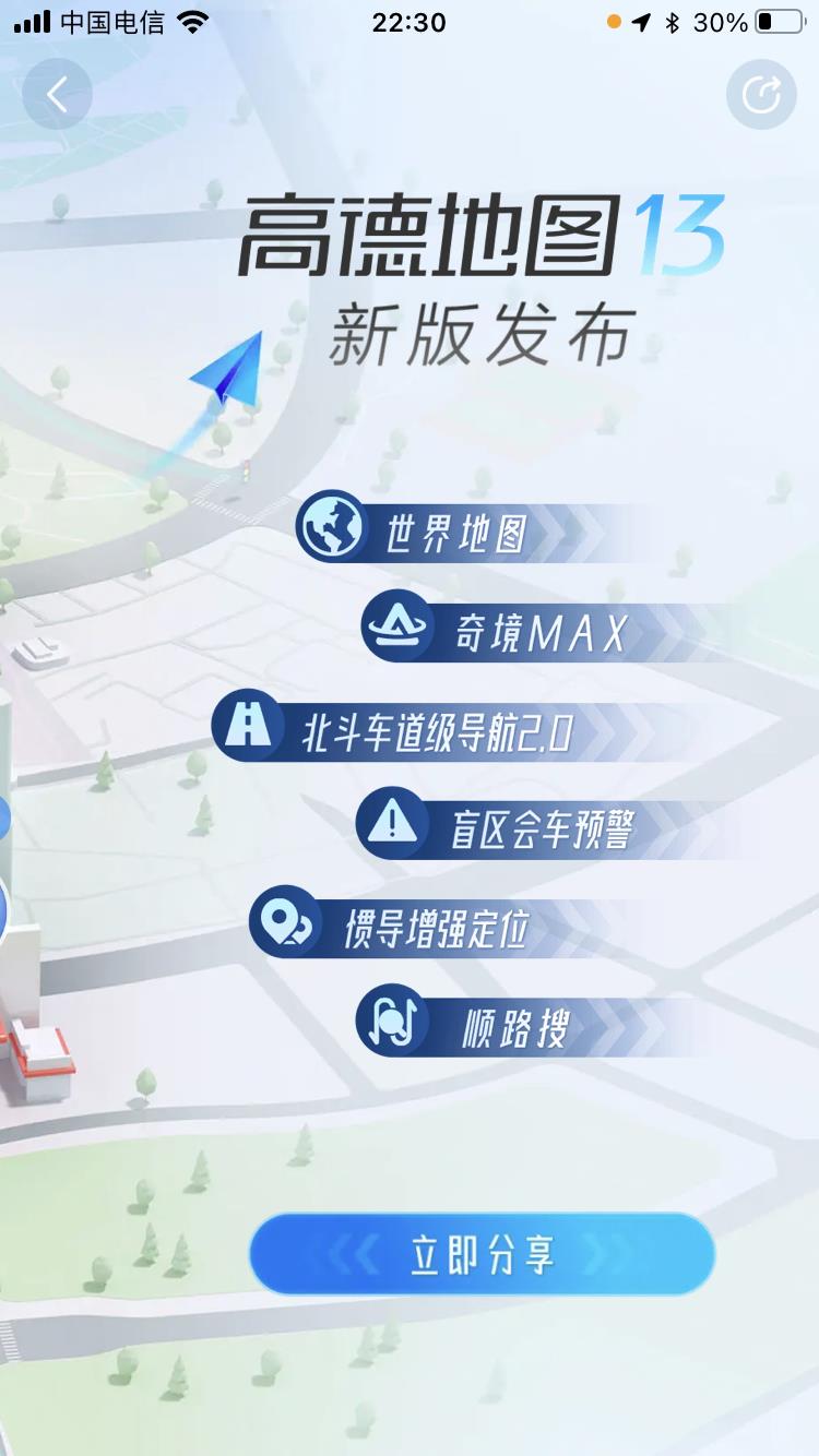
Recently, Autonavi officially released the Autonavi map v13 version, and announced the new generation of navigation engine "Wonderland" driving the flagship version.
According to reports, the Wonderland engine integrates a series of cutting-edge technologies such as Beidou positioning, neural rendering, and digital twins, while the Autonavi map v13 based on the engine includes "Wonderland MAX", world map, blind spot meeting warning, Beidou lane-level navigation 2.0, inertial navigation enhanced spatial positioning, and stop-by search. Function innovations provide users with a more accurate and immersive "time-space map" experience.
From now on, users can experience a new Autonavi map after updating the APP to the latest version.

Travel through time and space and experience "Wonderland"
As a domestic digital map content, navigation and location-based service solution provider, Autonavi Maps has always adhered to technological product innovation and led the development of the industry. Now, driven by the Wonderland engine, Autonavi Maps has further realized the "immersion" of users, and the core function of this concept is the "Wonderland MAX" that allows users to "travel through time and space".
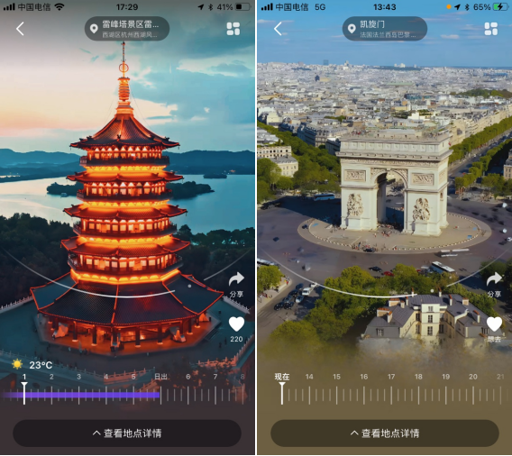
It is understood that Wonderland MAX is a new destination decision-making service developed by Autonavi Maps. Neural rendering technology based on deep neural networks and physical engines helps users see the scene from multiple time periods and directions by establishing a vivid and beautiful three-dimensional scene model on the map, so as to feel the cross-temporal and immersive "sense of presence" as an important reference information before traveling.

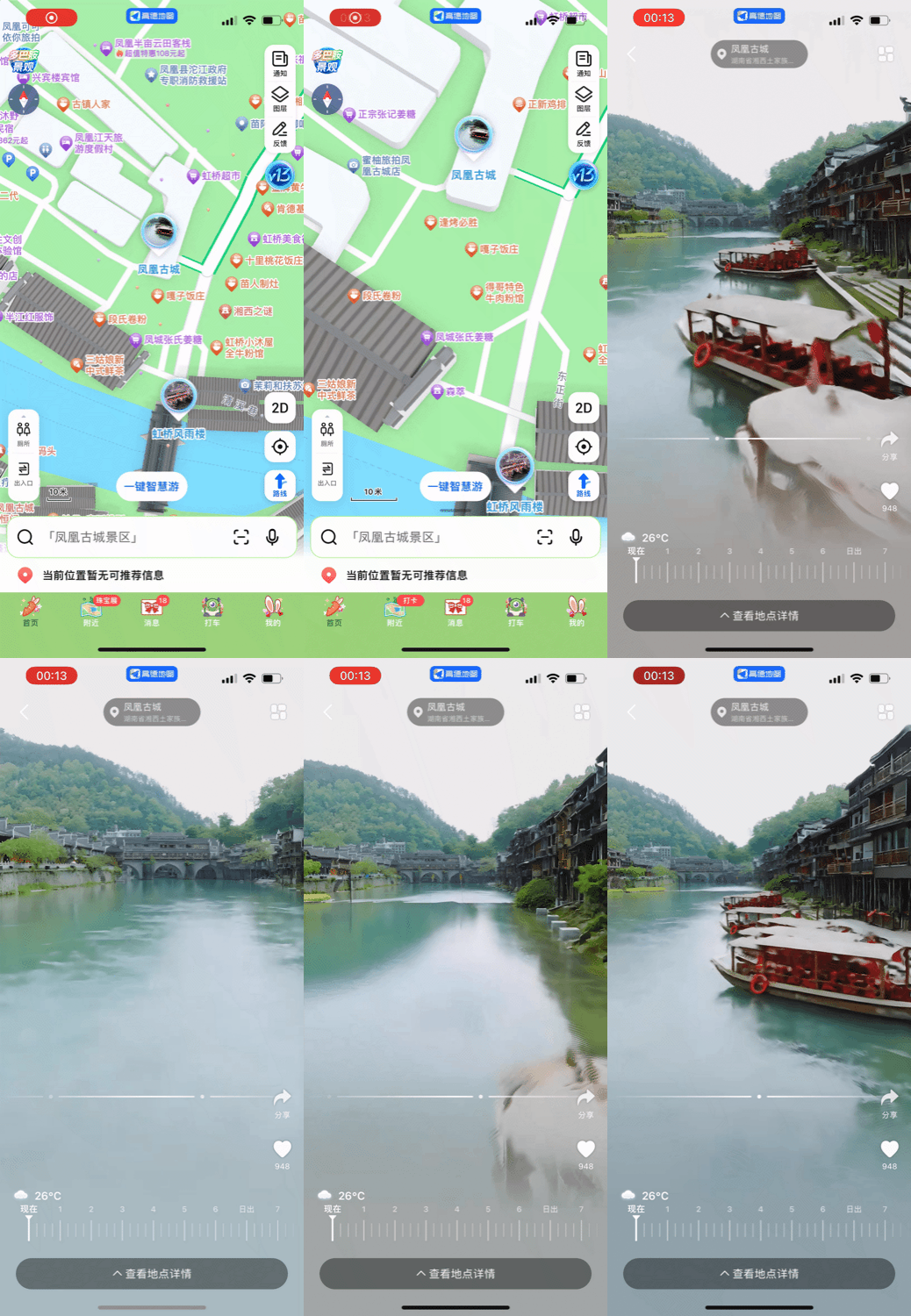
At present, Wonderland MAX has been widely used in well-known scenic spots and landmarks in China and some overseas. Users only need to zoom the map with two fingers on the APP, or search for the name of the popular scenic spot, and they can see the entrance to each wonderland. After entering the corresponding Wonderland MAX interface, they can also view the panoramic scenery at different time periods and angles. Some scenic spots can even render scene changes at night and in different seasons, presenting more stunning 3D light and shadow effects. In addition, users can also learn more about obtaining more detailed introductions and ticket purchase information of scenic spots, and navigate to them with one click.

Space-time interconnection, deducting the optimal solution for travel
Wonderland MAX assists users in making decisions before departure by creating a scene experience of "traveling through time and space, being in Wonderland". After the decision is made, travel is made. Other product functions of Autonavi Map v13 explain the meaning of "time and space map" from their own dimensions. Autonavi can provide users with more refined lane-level traffic incident warning and blind spot car meeting warning services:
Autonavi Beidou lane-level navigation 2.0 can accurately identify whether there are roadblocks or sudden brakes in front of the current lane, and inform users through navigation screens and voice broadcasts within a reasonable time frame to minimize driving safety hazards on high-speed and urban express sections.
The Autonavi mobile phone blind spot meeting warning service is to accurately identify blind spots such as curves and unlit intersections in space, and calculate a reasonable time advance based on static position and dynamic vehicle speed in real time, so as to intelligently alert users to the approaching traffic situation of roads in other directions.
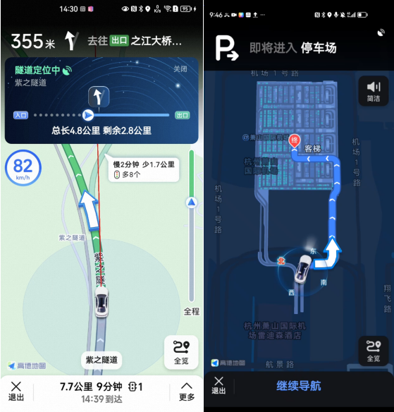
Autonavi map v13 is based on the self-developed "inertial navigation spatial positioning technology", and has upgraded services in a series of different scenarios such as tunnel navigation, elevated navigation, and parking space navigation. Now, whether it is inside and outside the tunnel, up and down the viaduct, or in the parking lot, users can enjoy more accurate and detailed spatial positioning services, making travel more worry-free.

In addition, there is the Autonavi drop-in search service that can "do everything by the way". Before the user drives or halfway through the journey, after adding the "route point" variable between the start and end points, Autonavi will calculate the optimal navigation route in real time, which combines time and space dimensions, so that the user can do things by the way as far as possible, and it will not take too much time.
The release of Autonavi Maps v13 signals that the industry as a whole has developed in depth towards the trend of "time and space interconnection". By connecting more physical details and elements in the real world, it continues to perform real-time large-scale interactive computing to deduce the optimal travel solution at the time and space level; coupled with the ability to provide users with a "time and space travel, immersion in wonderland" experience, realizing a complete out-of-home life service link from inquiry, decision-making, consumption to travel, which may become a new standard for future map navigation products.